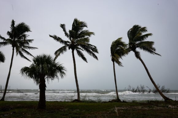
Hurricane Lee has become the strongest Atlantic storm since 2019 with winds of 165 miles (266 kilometers) per hour, and the US National Hurricane Center said the Category 5 system isn’t done growing yet. While the storm is far from land, forecasters aren’t certain of its ultimate path.
Lee’s top winds are forecast to reach 180 miles per hour later Friday as it moves “over even warmer waters,” John Cangialosi, a senior hurricane specialist at the center, wrote in his forecast.
“It is way too soon to know what level of impacts, if any, Lee might have along the US East Coast, Atlantic Canada, or Bermuda late next week, particularly since the hurricane is expected to slow down considerably over the southwestern Atlantic,” Cangialosi wrote. “Regardless, dangerous surf and rip currents are expected along most of the US East Coast beginning Sunday.”
If Lee’s winds reach their maximum forecast speed at 180 mph, it would be one of only seven in the satellite era since 1966 to reach that strength, Phil Klotzbach, a hurricane researcher at Colorado State University wrote in a social media post.
A climate change-fueled heat wave across the world’s oceans has been super-charging storms since January. On Thursday, in the Pacific west of Mexico, Hurricane Jova also reached Category 5 strength for a few hours with winds of 160 mph.
In addition to Lee, Tropical Storm Margot has also formed in the central Atlantic and is forecast to move north later next week in the vast open area of the ocean between Bermuda and the Azores. It is the basin’s 14th storm counting an unnamed system in January. This means the Atlantic, with more than two months remaining in hurricane season, has already produced an average year’s worth of storms.
In other weather news:
Japan: Tropical Storm Yun-yeung’s track has shifted slightly it is now heading more towards Tokyo. Emergency warnings have been posted along the coast and offshore islands in Chiba, Ibaraki, and Fukushima, according to Japan Meteorological Agency. Heavy rain warnings in urban areas around Tokyo Bay, including Yokohama and Kawasaki, the agency said. Tokyo is under thunderstorm advisories at present.
Hong Kong: The city’s heaviest rainstorm since records began in 1884 flooded the financial hub’s streets and sent torrents of water rushing through subway stations, bringing much of the city to a standstill and forcing the stock market to scrap trading on Friday.
US: The heat is back in Texas and the Southwest. The forecast high in Dallas is 108F degrees Friday and Phoenix could hit 112F Saturday.
UK: The country had its hottest day of the year on Thursday, while the autumnal heat wave that’s baking northwest Europe will continue through the weekend. A temperature of 32.6C (91F) was recorded at Wisley in southeast England, beating the previous highs from June, according to the Met Office. The mercury has exceeded 30C for four consecutive days, a new UK record for the month of September.
Was this article valuable?
Here are more articles you may enjoy.
 New EVs From Toyota, Subaru Breathe Life into Struggling Market
  Allianz Unit to Cut as Many as 1,800 Jobs in Push to Adopt AI
  New York, California Sizzle as Extreme Heat Strains Power Grids
  Clash of Florida Titans Pits Powerful Tribe Against Homebuilder Lennar
Want to stay up to date?
Get the latest insurance news
sent straight to your inbox.