
Hurricane Nolo is threatening Hawaii, a state already raked by multiple natural disasters since March that have caused hundreds of millions of dollars in damage.
Nolo’s top winds reached 75 miles (120 kilometers) per hour as it churned about 450 miles south-southeast of Honolulu, according to a US National Hurricane Center advisory. It is forecast to strengthen into a major hurricane, with winds reaching 120 mph, as it approaches Hawaii’s Big Island on Saturday.
Related: Hurricane Watch Posted on Hawaii’s Big Island as Nolo Approaches
The Big Island is under a hurricane watch, while flood and tropical storm watches are in effect for Maui, Lanai, Molokai and Kahoolawe.
Governor Josh Green said shelters are open on the Big Island for anyone wanting to leave their homes. Even before Nolo, the state had suffered “hundreds of millions of dollars in damage and impact on many houses,” he said in a video briefing.
In all, $211 million of state property has been damaged. While estimates for private buildings remain incomplete, more than 1,200 homes were damaged, including at least 74 that were destroyed, Green said. The state, a major tourist destination, has been pummeled by flooding from Kona lows in March, an earthquake in May and two major hurricanes in the past two months.
Even though Nolo is forecast to veer away from the islands, as much as 20 inches (50.8 centimeters) of rain is expected across the Big Island, with isolated totals of as much as 35 inches, the hurricane center said. The same area was battered by Hurricane Lala in August.
“This rainfall may produce catastrophic life-threatening flooding and mudslides, especially in steep terrain,” Eric Blake, a senior hurricane specialist at the US center, wrote in an analysis.
Nolo is forecast to come dangerously close to the Big Island before turning west, with its winds peaking at 120 mph, or Category 3 strength on the five-step Saffir-Simpson scale. Hawaii is rarely menaced by tropical systems but has had close calls with or been drenched by the remnants of seven storms this year.
Farther east, Hurricane Polo’s top winds dropped to 150 mph from 160 mph earlier, making it a Category 4 storm. Mexico has dropped all coastal warnings and watches as the storm pulls away from the coast.
Polo is still forecast to bring heavy rain to Mexico’s Guerrero state, with lesser amounts in Michoacan, Colima and Jalisco. The storm may strike Baja California next week and then cross northern Mexico as a tropical storm.
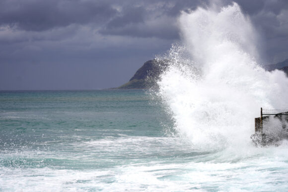
Top photo: A large wave crashes along the shoreline at Electric Beach in Waianae, Hawaii, on Sept. 7. Photographer: Michelle Bir /AFP/Getty Images. Bloomberg.
Was this article valuable?
Here are more articles you may enjoy.
 Tesla Drops ‘Self-Driving’ Branding to Appease Europe Regulators
  Apple, OpenAI Head to Court in High-Stakes AI Trade Secret Fight
  Burned by Fire, Malibu’s Million-Dollar Mansions Face a New Threat: El Niño
  Recovery Starts Before the Loss: What Claims Professionals Know About Severe Weather Preparedness
Want to stay up to date?
Get the latest insurance news
sent straight to your inbox.