Long-range forecasters say the harshest cold of winter is behind us, but the rest of the season will likely bring various weather threats, including ice jams, flooding, severe storms, and an increased risk of wildfires.
Rain and snow are expected to return to the Rockies and the Western U.S. over the next few weeks, but it will likely make a small dent in the snow drought and dry conditions across parts of the West.
Roughly 20% of the U.S. is currently dealing with severe, extreme, or exceptional drought conditions, compared to 17.6% at this time last year. Warmer and drier conditions in the region late this winter could increase wildfire risk sooner than many people expect, a new report from AccuWeather shows.
“The return of storms to the West Coast and Rockies is welcome news after significant water deficits, but it won’t completely erase long-term drought concerns,” stated Paul Pastelok, a lead long-range expert. “Warmer and drier conditions in the Southwest late this winter could increase wildfire risk sooner than many people expect.”
Snow cover across the contiguous U.S. stands at 30%. Snowpack at New England resorts is currently near 130% of historical averages, while many California resorts are roughly 40% below historical averages.
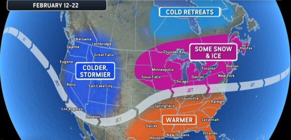
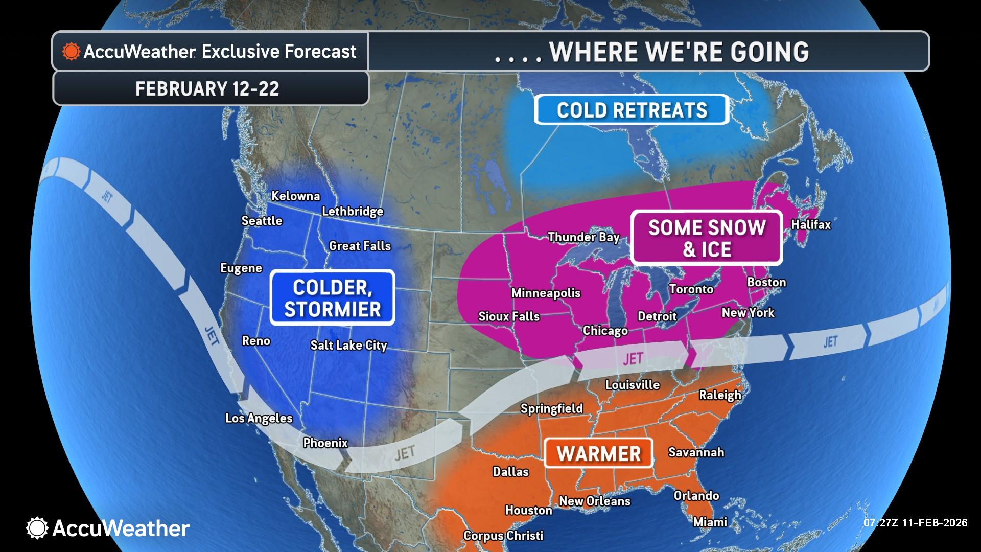
Forecasters expect a Valentine’s Day weekend storm to bring a risk of flooding and severe thunderstorms to parts of the South and Gulf Coast. The storm could bring some snow and ice impacts to parts of the Northeast, Great Lakes and Appalachians over the weekend. The storm could also slide off the Southeast coast, limiting the snow and ice risk farther north, according to AccuWeather.
Regions face an elevated risk of ice jams, river flooding.
Was this article valuable?
Here are more articles you may enjoy.
 Texas Floods, Canada Smoke and Western Heat Batter US
  US Appeals Court Revives Hundreds of Private Lawsuits Linking Tylenol to Autism
  CSU Lowers Atlantic Hurricane Forecast to ‘Well Below Normal’
  Clash of Florida Titans Pits Powerful Tribe Against Homebuilder Lennar
Want to stay up to date?
Get the latest insurance news
sent straight to your inbox.