A massive Pacific storm called an atmospheric river will sweep off the ocean into the Pacific Northwest starting Monday, bringing heavy rain and a week of floods, swollen rivers and even heavy snow across the region, including Seattle and Portland.
As much as 15 inches (38 centimeters) of rain may fall through the end of the week, with some areas in the Cascade Mountains getting up to 18 inches, which will lead to many areas that usually don’t flood to be inundated, said Andrew Orrison, a forecaster at the US Weather Prediction Center. The rain will arrive during the day Monday and continue through the night. It will slow on Tuesday, but the downpours will return Wednesday into Thursday, said Richard Bann, also a forecaster at the center.
Flood warnings and watches are posted throughout the area and because it will be a warmer storm it will be mainly rain except at the highest peaks in the mountains.
“If you look at things collectively out there, there are going to be multiple days of heavy rain – it is going to be a strong atmospheric river event,” Orrison said. “That is going to be the top story, certainly on the rainfall front.”
Atmospheric rivers are long plumes of moisture originating in the Pacific that can transport as much water as typically flows through the mouth of the Mississippi River when they crash ashore. The storms are ranked on a five-step scale and for many areas along the Washington and Oregon coast the current event is forecast to reach Category 4 levels, meaning it will be mainly hazardous, according to the Center for Western Weather and Water Extremes, at Scripps Institution of Oceanography at the University of California, San Diego.
The U.S. West depends on large Pacific storms, especially those bringing snow, to replenish regional water supplies, so not all storms are seen as bad.
The long duration will saturate soil so more rain will run off, causing floods and potentially landslides. The Willamette River in Oregon City is forecast to rise by more than 5 feet, while the nearby Clackamas River may swell by more than 13 feet, the weather service said. The Columbia River near Portland is set to rise by about 4.5 feet. In Washington, the Snoqualmie River near Carnation may rise 11 feet.
As the storm progresses, it will bring warmer air and rain to Idaho and Montana, which could trigger flooding there as well, Bann said.
Across the West as a whole, the last few months have seen a number of storms arrive from the Pacific, which has helped ease drought concerns. California, which will miss out on the current storm, has seen drought drop from 39.56% of its landscape three months ago to 0.15% as of last week, according to the US Drought Monitor. Washington, which was completely covered by drought three months ago, has seen the dryness footprint drop to 79.97% and Oregon also saw conditions improve by more than 20% with its current land area in drought only reaching 31.44%.
While there has been a lot of rain, mountain snows across the West are lagging behind normal and this could cause problems next year, the monitor said. Snowpack is often referred to as frozen reservoirs because it holds water into spring and summer months when it melts becoming available for the region’s large population, agriculture operations and hydroelectric dams.
“This is going to be a fairly long duration event,” Bann said.
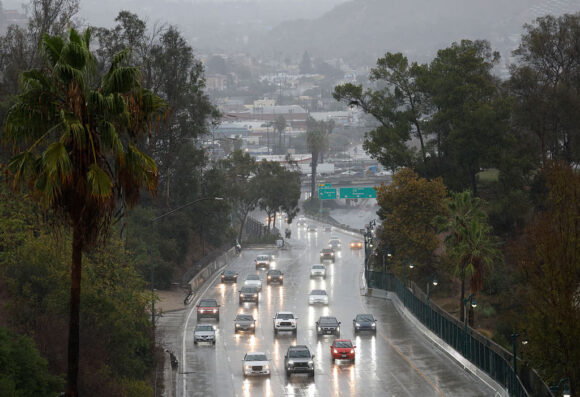
Top photo: Motorists drive toward downtown during a powerful atmospheric river storm on November 15, 2025 in Los Angeles, California. The multiple day storm is triggering evacuation and flash flood warnings today in the Eaton and Palisades fire burn scars due to debris flow fears. (Photo by Mario Tama/Getty Images).
Was this article valuable?
Here are more articles you may enjoy.
 US Appeals Court Revives Hundreds of Private Lawsuits Linking Tylenol to Autism
  Lawsuit Accuses Meta of Using AI to Target Workers With Medical Conditions for Layoffs
  Allianz Unit to Cut as Many as 1,800 Jobs in Push to Adopt AI
  NYC Building Scare Shows Challenges of Converting Offices to Housing
Want to stay up to date?
Get the latest insurance news
sent straight to your inbox.