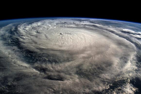
The world may be about to shift into a La Niña weather pattern, a development that would increase the risk of storms in the Atlantic as the height of hurricane season approaches there.
Forecasters at the U.S. Climate Prediction Center have issued a La Niña watch, meaning that the surface of the Pacific Ocean is poised to cool. The weather pattern tends to reduce sudden changes in wind speed and direction in the Atlantic, allowing more storms to take shape.
The agency said there is a 53% chance the weather-changing phenomenon will form sometime in September, October and November, the last three months of the hurricane season. A month ago, the odds were 47% for the same period.
Forecasters expect a weak La Niña could form in the Northern Hemisphere’s fall and early winter, with sea surface temperatures in a key part of the Pacific falling at least 0.5C (0.9F) below normal. In addition to its storm-boosting effects, La Niña can bring more drought to Southern California and crop-growing areas of Brazil and Argentina, as well as heavier rainfall to mining regions of Indonesia and northern Australia.
Was this article valuable?
Here are more articles you may enjoy.
 Ex-Banker Convicted in Deadly Car Crash Seeks Ferrari Records
  Xi Voices Worry on Work Safety After Shoe Factory Fire Kills 28
  US Hits Iran With Strikes, Blockade as Trump Plans Hormuz Charge
  Clash of Florida Titans Pits Powerful Tribe Against Homebuilder Lennar
Want to stay up to date?
Get the latest insurance news
sent straight to your inbox.