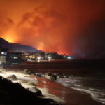
Meteorologists say Francine could produce life-threatening storm surge and dangerous flash flooding across parts of coastal Louisiana, Texas and Mississippi as it approaches the Gulf Coast.
AccuWeather meteorologists say the shallow continental shelf makes the Gulf coast “extremely vulnerable to storm surge.
The weather service is forecasting the threat of 6-10 feet of storm surge across parts of coastal Louisiana.
Tropical Storm Francine officially formed Monday morning in the warm waters of the Gulf of Mexico.
Francine is forecast to intensify into a Category 1 hurricane with maximum sustained winds of 74-95 mph on the Saffir-Simpson Hurricane Wind Scale before it makes landfall Wednesday.
“The extremely warm waters in the Gulf of Mexico act like rocket fuel for a developing storm,” stated AccuWeather Chief Meteorologist Jon Porter. “We’re concerned Francine will continue to intensify as it tracks north,” Porter explained “This storm is going to encounter disruptive wind shear, but it will also move through an area with very warm water and a lot of lifting in the atmosphere, which can help it intensify.”
While the wind shear will increase over the northern Gulf Coast as Francine approaches, near record high sea surface temperatures and ocean heat content could allow for rapid strengthening prior to landfall, according to AccuWeather.
Meteorologists are forecasting 60- to 80-mph wind gusts across parts of southern and central Louisiana. A zone of 80- to 100-mph wind gusts are expected in the area where Francine will make landfall.
Along with the threat of storm surge, the weather service is warning people along the Gulf coast to be prepared for the threat of flash flooding.
“This region is already soggy and saturated from heavy rainfall in the past few weeks. Flash flooding can happen very quickly,” warned Porter. “The risk of flash flooding will extend well inland as Francine tracks northeast toward the Mississippi Valley later this week.”
Meteorologists are forecasting 4-8 inches of rainfall through Friday across parts of coastal Texas, coastal and central Louisiana, as well as western Mississippi.
Meteorologists say Francine could evenrually reach major hurricane status as a Category 3 hurricane with maximum sustained winds of 111-129 mph on the Saffir-Simpson Hurricane Wind Scale as it moves over pockets of extremely warm water in the Gulf.
Meteorologists also say isolated tornadoes embedded in rainbands are possible east of the storm track, including New Orleans and Baton Rouge, Louisiana, as well as Jackson, Mississippi and Mobile, Alabama.
Was this article valuable?
Here are more articles you may enjoy.

 California Jet Fuel Woes Deepen as Asia Flows Hit Decade Low
  Bayer Banking on US Supreme Court’s Help to Rein in Roundup Lawsuits
  Travelers to Expand Homeowners Insurance Offering in California
  Insurer QBE Faces Investor Pressure Over Extreme Weather Risks