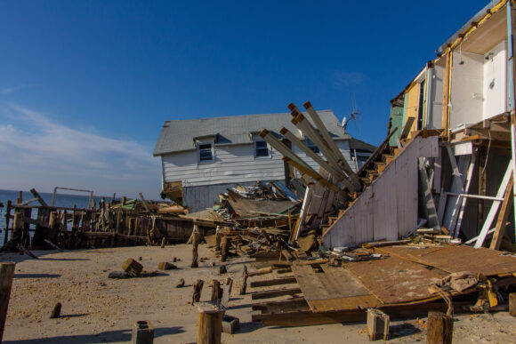
Superstorm Sandy victims in New Jersey who are weighing whether to rebuild or relocate will soon get more information that should help them decide what to do.
The Federal Emergency Management Agency will release updated flood work maps for Atlantic, Ocean, Monmouth and Hudson counties on Monday.
U.S. Sen. Robert Menendez of New Jersey says the new working maps that will be released will remove large areas from the so-called high-risk “velocity zone.”
FEMA in December released an advisory flood map based on data compiled before Sandy that showed the risk of flood levels was worse than believed. Homes in the V-zone would have to be raised or homeowners would risk higher premiums for flood insurance.
Homeowners feared they would not be able to afford the costs to comply.
Was this article valuable?
Here are more articles you may enjoy.
 Texas Floods, Canada Smoke and Western Heat Batter US
  Snap Nears Settlement of Addiction Case Ahead of Jury Trial
  Clash of Florida Titans Pits Powerful Tribe Against Homebuilder Lennar
  New EVs From Toyota, Subaru Breathe Life into Struggling Market
Want to stay up to date?
Get the latest insurance news
sent straight to your inbox.