Two years after a flood left Fort Kent under water, planning is under way to mitigate the future flood risk from the St. John River.
This month, the Federal Emergency Management Agency gave issued a report titled, “Living Behind the Levee: Fort Kent, Maine,” which examined factors that led to the April 2008 flood.
The flood was caused by snowmelt combined with 3 inches of rain. The earthen levee protecting downtown Fort Kent from the St. John held, but the Fish Fiver spilled its banks at the confluence with the St. John. Six hundred people had to be evacuated from Fort Kent.
John Bannen, director of planning and economic development, tells the Bangor Daily News that the FEMA report serves as a starting point for further discussions to mitigate flood risks.
Was this article valuable?
Here are more articles you may enjoy.
 A Super Yacht Armada Came to Miami, Leaving a Marine Graveyard in Its Wake
 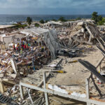 Venezuela Earthquake Death Toll Nears 2,000
  Citadel Securities Asks to Join Susquehanna Insider-Trading Suit
  10 Jurors Said Palisades Fire Suspect Isn’t Guilty. Now He Faces October Retrial.
Want to stay up to date?
Get the latest insurance news
sent straight to your inbox.