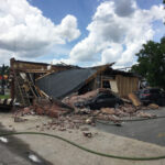
Charleston County, South Carolina has a new tool to help emergency crews better respond to 911 calls.
Dispatchers are using Pictometry, a new system that brings up a picture of the location and neighborhood from where a 911 call originated. Operators previously depended on software maps that resembled a car GPS system.
The new system allows dispatchers to tell police, ambulance drivers and other emergency responders about a building’s size or any other obstacles they may encounter.
The county’s telecommunications director William Tunick says the system allows dispatchers to see a building from any direction or from above to help emergency crews quickly respond to 911 calls for help.
Was this article valuable?
Here are more articles you may enjoy.
 Navigators Can’t Parse ‘Additional Insured’ Policy Wording in Georgia Explosion Case
  Uber Jury Awards $8.5 Million Damages in Sexual Assault Case
  Elon Musk Alone Can’t Explain Tesla’s Owner Exodus
  Hackers Hit Sensitive Targets in 37 Nations in Spying Plot
Want to stay up to date?
Get the latest insurance news
sent straight to your inbox.