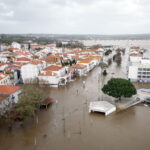
The National Hurricane Center reported on Sunday evening that Hurricane Wilma was speeding up, moving northeast at 14 mph and expected to make landfall on Florida’s west coast early Monday morning. When Wilma makes landfall it is expected to be a Category 2 or 3 storm packing around 110 mph sustained winds. A hurricane watch was in effect from Tampa, Fla. all the way south to the Florida Keys.
Predictions called for Wilma’s eye to make landfall around Marco Island or Naples, Fla. on the southwest tip of Florida.
At 8 pm EDT Sunday, data from an air force reserve hurricane hunter aircraft, National Oceanographic and Atmospheric Administration Doppler radars and satellite images showed the center of the large eye of Hurricane Wilma was near latitude 23.9 north, longitude 84.4 west, or about 170 miles west-southwest of Key West, Fla. and about 225 miles southwest of the southwestern coast of the Florida Peninsula.
Wilma was moving toward the northeast near 15 mph in a continued northeastward motion. A gradual increase in forward speed was forecast Sunday night and Monday. On this track, the center of Wilma is forecast to be near the southwestern coast of the Florida Peninsula early Monday morning. However, Wilma is a large system and tropical storm force winds will reach the Florida Keys and Florida Peninsula well before the eye makes landfall.
Data from air force and NOAA hurricane hunter aircraft Sunday evening indicated maximum sustained winds had increased to near 110 mph with higher gusts. Wilma is a strong category two hurricane. Additional strengthening was possible Sunday night and early Monday and Wilma could be near Category 3 major hurricane strength as it nears the southwestern Florida coast Monday morning.
Hurricane force winds extended outward up to 85 miles from the center and tropical storm force winds extend outward up to 230 miles. A wind gust to 85 mph was reported in Havana Cuba and a gust to 55 mph was reported at Dry Tortugas. Sustained tropical storm force winds are occurring over the Yucatan channel and western Cuba and these winds should reach the lower Florida keys by midnight and spread eastward to the middle Keys and the southwest Florida coast by sunrise Monday morning.
Storm surge flooding of 9 to 17 ft above normal tide levels is possible along the southwest Florida coast near and to the south of where the center of Wilma makes landfall. Storm surge flooding of 5 to 8 ft. above normal is possible in the Florida Keys and Florida Bay, as well as in Lake Okeechobee. Storm surge flooding of 2 to 4 feet is possible along the extreme southeastern coast of Florida.
Storm surge flooding of 8 to 13 ft above normal tide levels is possible along the southwest Florida coast near and to the south of where the center of Wilma makes landfall. Storm surge flooding of 5 to 8 ft above normal is possible in the Florida Keys and Florida Bay.as well as in Lake Okeechobee. Storm surge flooding of 2 to 4 feet is possible along the extreme southeastern coast of Florida.
Saturday, Key West officials issued a voluntary evacuation order after which visitors and residents began a well-orchestrated retreat to the U.S. mainland. Hospitals along the western Florida coast were discharging patients and reducing surgeries in efforts to make sure patients would be able to evacuate as soon as the evacuation order is given.
The initial bands of wind and rain from Hurricane Wilma began to hit Florida, as far north as Gainesville on Saturday, advance notice of worsening weather conditions.
Wilma is the 21st named storm of the season and the 12th hurricane of the season.
A tropical storm warning is in effect for the provinces of La Habana, Ciudad de la Habana, Pinar del Rio and the Isle of Youth. A hurricane watch remains in effect in Cuba for the provinces of Matanzas, westward through Pinar del Rio and the Isle of Youth.
Residents began leaving the Florida Keys and parts of the mainland on Friday as the Category 4 tempest slammed into Mexico’s Yucatan Peninsula.
“Florida should take advantage of the slow pace and use this time to stock up on supplies and prepare,” Gov. Jeb Bush told reporters.
Scattered gas shortages were reported but Bush said the state had a 10-day supply. Traffic jams backed up highways as people fled the west coast, but state troopers told the governor most of the congestion was due to accidents.
Editor’s note: See related item in International news.
Was this article valuable?
Here are more articles you may enjoy.

 Uber Jury Awards $8.5 Million Damages in Sexual Assault Case
  Tesla Sued Over Crash That Trapped, Killed Massachusetts Driver
  Berkshire Utility Presses Wildfire Appeal With Billions at Stake
  Portugal Rolls Out $2.9 Billion Aid as Deadly Flooding Spreads