Storms and tornadoes are in the forecast for states across the Midwest in the US, with further weather warnings and advisories stretching further east.
There is a moderate risk of severe thunderstorms — which could bring hail, tornadoes, and straight-line winds on Tuesday — across the Ohio Valley, including Columbus, Cincinnati and Louisville, the US Storm Prediction Center said. About 8.9 million people are in the path of the worst weather, while another 45 million face a enhanced to slight risk across the eastern US.
Tornado watches are up across parts of Missouri, Illinois, Kentucky and Indiana and flood watches and advisories stretch as far east as Pennsylvania and Maryland, the National Weather Service said. At 6:18 a.m. New York time, a tornado warning was up across the southern tip of Illinois and a small part of Kentucky.
Further east, winter is set to make a rebound across Upstate New York and northern New England. A winter storm watch is in place from Lake Ontario’s eastern shore to Maine’s Atlantic coast. As much as 6 inches (15 cm) of snow and sleet may fall across Maine pushed along by wind gusts up to 55 miles per hour (88.5 kph) through Thursday, the National Weather Service said. The areas along New York’s Lake Ontario shoreline may get 7 inches.
Meanwhile, California is unlikely to have a repeat of last year’s super bloom of flowers. That’s because super blooms are preceded by drought, and this winter there had plenty of rain and snow, according to Heather Schneider, a rare plant scientists at the Santa Barbara Botanic Garden.
Schneider said that places that had super blooms a year ago are now having non-native grasses flourish, which are outcompeting the California flowers. This can have deadly consequences later in the year when wildfire season starts.
Native flowers break down quickly and leave bare patches on the landscape that can slow fires, non-native plants hold on and fill in those gaps.
“With the non-native annual grasses especially, they create a standing biomass of fine fuel,” Schneider said. “When fires start that grass acts as really great tinder and it also creates a fine connective fuel so the fire can connect all the dots between the shrubs. So it creates bigger fires and sometimes leads to hotter fires.”
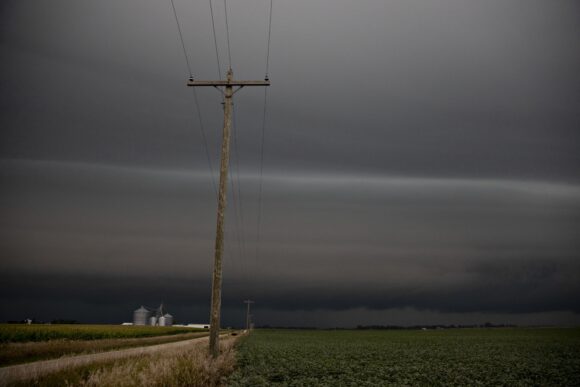
Top photo: Storm clouds hang over farm fields in Chatsworth, Illinois, U.S., on Tuesday, Aug. 20, 2019. Inconsistency is the one constant coming out of a major U.S. crop tour that kicked off on Monday as scouts get to see first hand the impact of wild weather on Midwestern corn and soybean fields.
Was this article valuable?
Here are more articles you may enjoy.
 Citadel Securities Asks to Join Susquehanna Insider-Trading Suit
  CSU Lowers Atlantic Hurricane Forecast to ‘Well Below Normal’
  US Considers Creating Finra-Like Watchdog to Vet Top AI Models
  New York, California Sizzle as Extreme Heat Strains Power Grids
Want to stay up to date?
Get the latest insurance news
sent straight to your inbox.