Experts predicted insured losses from Hurricane Ian could earn it a spot as one of the costliest natural disasters in history after the storm rapidly intensified before coming ashore in Southwest Florida with 150 mph wind and began a crawl across the Florida peninsula while dropping up to 20 inches of rain.
Insurance broker BMS Group on Wednesday projected insured losses of $20 billion from the hurricane. The Insurance Information Institute went further.
“Our projection is Hurricane Ian could potentially generate more than $30 billion in insured property losses, which would make it one of the largest natural catastrophe events in US history,” said III Communications Director Mark Friedlander.
Artemis owner Steve Evans said in a blog post that $20 billion “seems like a safe starting point.”
“The top-end insurance and reinsurance market loss estimate still seems likely to be up to $40 billion, unless hurricane Ian causes more damage than expected to metro areas like Orlando as it crosses Florida, or causes a larger than expected loss when making a second landfall on the US southeast coastline,” Evans wrote Wednesday afternoon. His company tracks the reinsurance and catastrophe bond market.
That level of damage is rarely seen. Hurricane Ida caused an estimated $36 gillion in insured property loss after striking the New Orleans area last August, becoming the second-most costly US natural catastrophe, according to the Insurance Information Institute. Hurricane Sandy in 2012, Harvey, Irma and Maria in 2017 each caused similar losses.
Hurricane Katrina in 2005, with $89.6 billion in insured losses, was the most expensive natural catastrophe on record. All of the preceding figures were converted to 2021 equivalents.
Artemis’ Evans reported that Karen Clark & Co. sent clients two modeled loss estimates on Tuesday; one that showed $32.5 billion in insured losses if the hurricane came ashore on Sarasota County’s Longboat Key. Another estimate with a landfall to the south near Venice was projected to cause insured losses of $19 billion.
A spokesman for KCC refused to confirm the accuracy of Evans’ report, saying its projections are confidential and intended for its clients.
Ian turned toward the east earlier than forecasters initially projected and made landfall near Port Charlotte. The National Hurricane Center said landfall was at Cayo Costa, between Fort Myers and Cape Coral.
Accuweather reported that Hurricane Ian submerged Fort Meyers Beach as it made landfall, with floodwaters submerging cars and reaching the roof of one residence. Also, downed power lines in Naples and Tampa caused a string of fires.
CoreLogic, a property data analytics firm, reported Wednesday that Ian promises to be a “history-making hurricane.” Jon Schneyer, senior catastrophe response manager, wrote that 7.2 million Florida homes with a reconstruction value of $1.6 trillion lie in the hurricane’s projected path.
Schneyer said the National Hurricane Center warned that the entire state of Florida is at some level of flash food due to heavy rainfall. While most of the state had a moderate risk, the Tampa-St. Petersburg metro area and Orlando had a 70% chance of flooding.
Hurricane Ian’s impact combines dangers components of three infamous landfalling hurricanes, Andrew in 1992, Katrina and Irma, Schneyer said. Ian made landfall in a densely populated area with strong winds that are expected to remain at hurricane force for hours.
According to the Insurance Information Institute, three metropolitan areas that were near Ian’s center at landfall are among the top 15 US metropolitan areas at risk for storm surge damage: Naples, North Port and Port Charlotte. Together those cities had more than 800,000 homes in harm’s way.
On Wednesday afternoon, Ian was moving to the north-northeast at 8 mph, which will keep it over the Florida peninsula until this afternoon. Hurricane-force winds extended 50 miles from the eye of the hurricane and tropical storm-force winds 175 miles.
Forecasters predicted Ian will turn to the northwest after crossing over to the Atlantic Ocean near Daytona Beach, where it will present a new storm surge threat to the northeastern Florida, Georgia and South Carolina coasts.
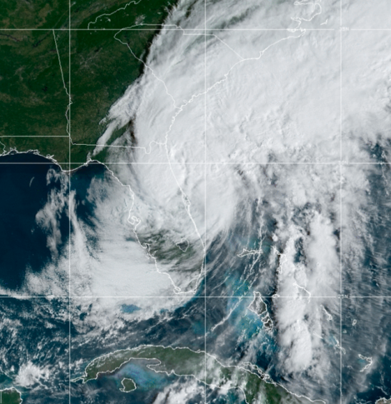
About the photo: This photo, downloaded from the National Weather Service website, shows Ian as it moves offshore on Thursday, Sept. 29, after being downgraded to tropical storm status.
Was this article valuable?
Here are more articles you may enjoy.
 Frustration Grows in Venezuela as Earthquake Death Toll Rises
  Carlyle Rethinks Portfolio Risk to Give Weather Insurance a Bigger Role
  US Decides Against Renewing USMCA, Shifting to Rolling Talks
  Flood Re to Cut Insurance Payouts to Richest UK Households
Want to stay up to date?
Get the latest insurance news
sent straight to your inbox.