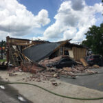
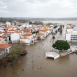
EQECAT Inc. announced that in response to growing concerns over increasing wildfire and flood losses, it has released the first probabilistic models for managing property risk due to wildfire and flood in the U.S.
“Industry losses due to wildfires and flood are growing and annually exceed a billion dollars,” noted Thomas Larsen, senior vice-president, product management at EQECAT. “Managing exposure to these perils is an industry-wide concern, and EQECAT’s probabilistic modeling tool will enable insurers to better understand and predict the losses inherent in wildfires and floods.”
He indicated that “EQECAT is in a unique position to be able to provide these tools because of its experience in helping in the development of the U.S flood model for the U.S. Federal Emergency Management Agency (FEMA) and modeling wildfire loss potential for the Fair Access to Insurance Requirements (FAIR).”
The announcement noted that there is “growing concern in the insurance industry because of a recent trend toward increased losses from wildfires and floods. Increased exposure reflects population growth, forcing new development adjacent to wild lands and flood prone areas. These factors, coupled with changes in weather patterns and rainfall, have heightened loss potential. The insured loss from last year’s fires in California alone was $2 billion. More than seven million homes in California are in areas categorized in the three highest fire-risk levels. Insurers are also exposed to increasing flood losses for commercial and industrial properties.”
EQECAT said the U.S. Wildfire licensed-model is based upon its previous wildfire consulting platform, which has been used in the insurance industry since 1999 for insurer consulting studies to estimate potential portfolio property losses.
The new Wildfire model “takes into account key factors such as fuel load — type of fuel and density — windspeed and direction, humidity, and terrain features to determine fire ignition probabilities and the rate of fire growth” said the announcement. “Fire suppression capability is based upon known water supplies, air tankers, site access for firefighters and equipment and overall fire fighting resources in each area. The new model also takes into account differences in the vulnerability of structure types, such as homes with a wood-shake versus fire-retardant roof, as well as distance from brush-clearing setbacks.
“The EQECAT model produces a fully probabilistic loss non-exceedance distribution, per occurrence and annual aggregate, along with an expected annual loss. Policies can be analyzed at the street address level of detail and results viewed by policy-site, by geographic area, such as ZIP code, county or state, or the insurer’s overall portfolio.”
Concerning its U.S. Flood model, EQECAT indicated it “is a single-location, probabilistic analysis model covering the continental U.S. for areas adjacent to rivers and similar water bodies, and those subject to coastal flooding. EQECAT’s flood analysis is based on the development of a probabilistic flood hazard map for the U.S using historical data, including flood height, river discharge and frequency distributions for flood-peak discharge, collected from rivers equipped with measuring instruments, known as gauged rivers. Data from ungauged rivers have been developed using information transferred from gauged sites by relating flood characteristics to watershed and climatic conditions through correlation techniques.”
EQECAT said “the newly released model takes into account all the relevant risk factors such as river drainage area, main channel slope, mean annual precipitation in the basin, rainfall, land use and land cover, basin shape, and porosity of the soil.
“The probabilistic analysis also utilizes the FEMA Q3 Flood Zones, updated to account for more recent local studies. The EQECAT U.S. Flood model uses the latest Digital Elevation Maps (DEM) from the U.S. Geological Survey (USGS) among other sources, as well as USGS-Environmental Protection Agency (EPA) stream database seasonal river flows. The model also uses vulnerability curves based on claims data, and research performed by several institutes such as the Federal Insurance Administration, the U.S. Army Corps of Engineers, and the Institute for Water Resources. These vulnerability curves differentiate the loss potential by occupancy, such as residential, commercial, industrial, as well as with several subcategories, and coverage type, such as building, contents. EQECAT’s U.S. Flood model enables underwriters to graphically see the proximity of a site to flood zones, a cross-section of surrounding terrain, and provides probabilistic damage and loss estimates for each site.”
The EQECAT U.S. Wildfire and U.S. Flood models are available immediately. For additional information, visit www.absconsulting.com, or www.eqecat.com.
Was this article valuable?
Here are more articles you may enjoy.

 Navigators Can’t Parse ‘Additional Insured’ Policy Wording in Georgia Explosion Case
  Portugal Rolls Out $2.9 Billion Aid as Deadly Flooding Spreads
  China Bans Hidden Car Door Handles in World-First Safety Policy
  Credit Suisse Nazi Probe Reveals Fresh SS Ties, Senator Says