New research by the U.S. Geological Society suggests that while the New Madrid Seismic Zone hasn’t produced a major earthquake in more than 200 years, the risk remains.
The Southeast Missourian reports that scientists used new technology to develop high-resolution imagery of the seismic zone centered around New Madrid, Mo. The imagery allows for more detailed mapping, showing weak rocks in the zone that are found at deeper depths in the Earth’s mantle compared to surrounding areas.
Findings were published recently in the Earth and Planetary Science Letters journal.
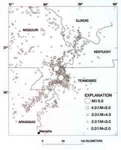
The seismic zone produced massive earthquakes, including three greater than magnitude 7, in 1811 and 1812. The quakes were so strong that the Mississippi River reportedly flowed backward and church bells rang as far away as New England.
Charles Langston, director of the Center for Earthquake Research and Information at the University of Memphis, said at least 200 earthquakes occur in the seismic zone every year, but most are very small. He said there is a 7-10 percent chance of a magnitude 7.5 or larger quake in the zone in the next half-century, and a 25-40 percent chance of a magnitude 6 quake or larger in the same period.
“So there’s a good chance we could have a damaging quake in the next 50 years,” Langston said.
The USGS scientists used data from USArray, a network of 400 seismometers that is part of the National Science Foundation’s EarthScope Program. A surprising finding was that weak rocks underlie the fault lines in the crust of what is known as the Reelfoot Rift area of the seismic zone and extend more than 100 miles down into the mantle – far deeper than in other ancient rift zones in the central and eastern U.S.
The weak mantle rocks have low seismic velocity, which means they are more susceptible to concentration of tectonic stress and more mobile.
USGS scientists in the future plan to use USArray to map the seismic structure of the entire nation. The effort started in California in 2004. It will next focus on the East Coast, then Alaska.
Was this article valuable?
Here are more articles you may enjoy.
 Citadel Securities Asks to Join Susquehanna Insider-Trading Suit
  Insurer Interest in AI Exclusions Growing as Risk Becomes Omnipresent
  US Considers Creating Finra-Like Watchdog to Vet Top AI Models
  US Hits Iran With Strikes, Blockade as Trump Plans Hormuz Charge
Want to stay up to date?
Get the latest insurance news
sent straight to your inbox.