The U.S. Army Corps of Engineers has released a draft report that calls for a better, if limited, flood-protection system in Cedar Rapids, Iowa.
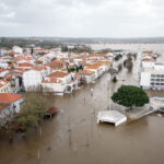
The Cedar River swamped the city in 2008, covering 10 square miles.
The city’s existing system “does not provide protection,” according to the three-page executive summary of the more than 1,600-page report released Sept. 1.
The Gazette reports the plan calls for basic concrete flood walls to protect most of the east side of the river in downtown. It would protect the Quaker Co. plant and the Cargill plant downriver.
The report contains the same conclusions that the corps made public in June, which the City Council rejected because it also wants flood control on the west side of the river.
The council has said it will lobby the Corps leadership in Washington, D.C., and Iowa’s congressional delegation in hopes getting a more extensive flood-protection system.
The Corps’ plan would include 2.17 miles of concrete flood walls, three-quarters of a mile of earthen levees and .23 miles of flood-control structures around bridges.
The Corps figures there is a 91 percent chance its recommended system won’t be overtopped by flood water and the value of the property it would protect is just over the cost of building it.
The cost is estimated at $98.8 million, with $34.6 million of that coming from the city of Cedar Rapids.
City leaders were encouraging residents to review the report and send comments to the Corps. The report is available at the Corps’ Rock Island District Web site and at the Cedar Rapids Public Library.
Was this article valuable?
Here are more articles you may enjoy.

 Portugal Rolls Out $2.9 Billion Aid as Deadly Flooding Spreads
  Hackers Hit Sensitive Targets in 37 Nations in Spying Plot
  Navigators Can’t Parse ‘Additional Insured’ Policy Wording in Georgia Explosion Case
  US Will Test Infant Formula to See If Botulism Is Wider Risk