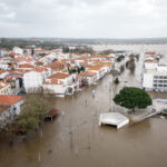
Officials of cities along the Red River are preparing for the worst while they await an updated spring flood forecast Friday.
Wilkin County, Minn., engineer Tom Richels says the county has lined up pumps and sandbags. He expects conditions similar to 2006, when the county was declared a disaster area.
“We’ve been concerned since it started raining last fall,” Richels said. “I think it’s going to be mostly a rural event this year. Cities are better protected now, but we expect overland flooding, most likely significant overland flooding.”
At a meeting Tuesday in Grand Forks, Andrea Holz, a hydrologist with the North Central River Forecast Center in Minneapolis, said frost depths in the area are higher than average due to about six weeks of below-freezing temperatures without much snow to cover the ground. Moisture downstream may have gone into the soil and froze again, she said.
Holz estimated the Red would crest between 45 feet and 50 feet in Grand Forks. It could cause flooding along the city’s greenway.
The river crested at a record 54 feet in Grand Forks in 1997, leading to a more than $400 million dike system built to hold back floods of as high as 58 feet.
Steve Buan, the lead forecaster for the National Weather Service River Forecast Center in Chanhassen, Minn., met with Fargo officials Monday. He said he expects a Red River crest in Fargo in the mid-30 foot range. Flood stage for the Red in Fargo is 18 feet. Fargo officials have said they would have to build a dike to protect City Hall if the river gets to 31 feet.
“I think there’s a pretty significant risk of a spring flood,” Buan said, “and just how bad that’s going to be will be played out, but I think there’s a pretty significant risk.”
Fargo City Engineer Mark Bittner said the biggest threat may be from the Wild Rice River on Fargo’s south end.
“Obviously the Wild Rice does impact a lot of properties in south and southwest Fargo and those rural subdivisions,” Bittner said.
Tim Fay, an engineer with the North Dakota State Water Commission, said the heavy rain and snow during the fall and early winter is unusual. The Red River Valley is not the only area impacted, he said.
“The deepest and wettest of the snow seems to be in the upper Sheyenne Basin right in the middle of the state, in the Fessenden-Harvey areas,” Fay said. “Folks around there are not accustomed to having flood conditions. It’s important they are on their toes and not be taken by surprise. It’s not just homes in towns, it’s infrastructure.”
___
Information from: KFGO-AM, http://kfgo.com
Was this article valuable?
Here are more articles you may enjoy.

 Founder of Auto Parts Maker Charged With Fraud That Wiped Out Billions
  UBS Top Executives to Appear at Senate Hearing on Credit Suisse Nazi Accounts
  Portugal Rolls Out $2.9 Billion Aid as Deadly Flooding Spreads
  Navigators Can’t Parse ‘Additional Insured’ Policy Wording in Georgia Explosion Case