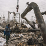
The world really gets no respite from global weather events. Just as the hurricane season draws to a close, the European windstorm season, which usually lasts around four months, starts up.
In its examination of the onset of bad weather for Europe, Lloyd’s notes that, unlike hurricanes, “no one quite knows what to expect.” Scientists just aren’t able to make forecasts of the frequency or the intensity of the storms. All they know is that they will occur.
“That’s because all the phenomena which are found to modulate the rate of arrival of winter storms in Europe have typical timescales of only one to two weeks, compared to the months and years’ worth of climatic factors that influence hurricane formation in the US,” explained Dr. Renato Vitolo, Willis Reserarch Fellow at the University of Exeter. “The linear autocorrelation in the signal decays quickly and is no longer significant after three weeks. I reckon that is the current limit of any ‘seasonal’ or ‘extended range’ forecast,” he told lloyds.com.
The storms, or more properly “extratropical cyclones (ETC’s), are severe. The most damaging in the last five years have been Kyrill in 2007, Klaus in 2009 and Xynthia, earlier this year. “Between them they cost the insurance market around €6 billion {$7.83 billion],” Lloyd’s said.
However, the article does point out that some progress is being made. It cited the recent publication by Aon Benfield, in conjunction with the University of Cologne, on uncommon European winter storm tracks. The research points to a lower total number of storms in the future but indicates intense storms increasingly moving over the North and Baltic Seas towards Eastern Europe, following a similar path to windstorm Kyrill.
Dr Alexandros Georgiadis, catastrophe model developer at Impact Forecasting, part of Aon Benfield, explained that existing catastrophe models only partially capture the climatological variability of European windstorms. He stressed that the “next generation of catastrophe models must address these challenges as model developers expand coverage into new European territories, responding to higher insurance market penetration in Central and Eastern Europe.”
Impact Forecasting is working with the University of Cologne to create a pan-European windstorm model that allows detailed analysis of the impact of extreme windstorms on re/insurers’ European portfolios. Risk management Solutions is readying an updated version of its Europe Windstorm Model, using more claims and meteorological data than before.
AIR Worldwide says it has incorporated more wind speed observations as well as recent claims data to refine its widely used extratropical cyclone (ETC) model for Europe. AIR says it has also included European windstorm clusters in its update.
Lloyd’s singled out Willis, which, through the Willis Research Network, “has concentrated on the phenomenon of storm clustering. A cluster is a group of storms occurring over a short time span and affecting a particular geographical region.”
As examples Lloyd’s cited Lothar and Martin, which rolled over the continent just 36 hours apart and caused in excess of $15 billion in damages and around $11 billion in insured losses. Similarly, in January 1990 Windstorm Daria caused losses of $4.5 billion and was followed four weeks later by storms Vivian and Wiebke.
There is speculation that global warming/climate change may be influencing the storm patterns. But, as Lloyd’s points out the “scientific jury is out over whether European windstorms’ intensity or frequency is increasing due to climate change, partly because there is an intrinsic difficulty in defining what an extratropical cyclone actually is.” Dr. Vitolo added: “That’s because ETCs display a huge variability in shape and size, as opposed to tropical cyclones (hurricanes and typhoons), which exhibit a clear-cut general structure.”
Dr. Vitolo, who specializes in the predictability of extreme weather events, pointed out that there is agreement across scientific studies about a general decrease in the number of all ETCs in the northern hemisphere. On the other hand, several studies suggest a regional increase in extreme cyclones in the north east Atlantic, adjacent to Central Europe, as noted by Aon Benfield.
But, the large variety of methods and criteria used to track extratropical cyclones, makes it difficult to compare different studies and, as Dr. Vitolo indicated, any clear picture of European winter storm is still clouded by uncertainty.
Source: Lloyd’s of London
Was this article valuable?
Here are more articles you may enjoy.

 Ransom Attacks up, but Payments Headed Down as Cyber Becomes Top of Mind
  Sabotage Threats Have Put Europe’s Power Networks on Alert
  Waymo Recalls Robotaxis After Vehicle Drove on a Flooded Road
  Worst Start to Wildfire Season Raises Alarm as El Niño Threatens