A new floodplain map under development for Cedar Rapids, Iowa, shows a levee on the Cedar River’s west bank was too low to protect large sections of the city from a 100-year flood.
That’s despite the fact that the properties weren’t previously considered to be part of the 100-year flood plain.
The Federal Emergency Management Agency has been working on a new floodplain map since before flooding soaked most of downtown Cedar Rapids. The maps matter because, once they’re published, they determine which property owners are required to buy flood insurance.
Cedar Rapids Public Works Director Dave Elgin says the city’s old 100-year-flood plain map was inaccurate because it was based on imprecise information.
It’s unclear if the map will change more as officials consider last month’s floods.
Information from: The Gazette, www.gazetteonline.com/
Was this article valuable?
Here are more articles you may enjoy.
 IBM, AT&T Accused by Whistleblower of Covering Up Foreign Hacks
 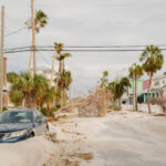 Report: Extreme Weather to Drive $20 Trillion in Spending
  Jefferies Sued by Fund Investors Alleging Water Firm Fraud
  Deadly Screwworm Parasite Found in US Threatens Cattle Herd
Want to stay up to date?
Get the latest insurance news
sent straight to your inbox.