LIDAR News

After Oso Landslide, Washington Offers Online Access to Topographical Maps

Washington’s Department of Natural Resources is following through with a key safety recommendation that arose in the aftermath of the Oso mudslide, as it starts to post intricate topographical maps online. The state generates the maps through laser-imaging technology known …

Waymo Autonomous Minivan to Start Test Drives This Month

Waymo, Google’s self-driving car division, will start testing its new fleet of minivans on public roads in California and Arizona later this month. The minivans, built in collaboration with Fiat Chrysler, are Chrysler Pacifica hybrids outfitted with Waymo’s own suite …

New Maps Highlight History of Columbia River Gorge Landslides

The Columbia River Gorge is famous for sweeping dramatic vistas, but new research published by the U.S. Geological Survey reveals a shifting landscape beneath the forest. Three researchers with USGS mapped a history of 215 different landslides across 64 percent …

CES Show Highlights Autonomous Car Breakthroughs

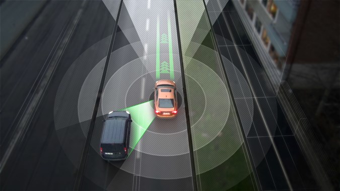
Powerful computers that can drive better than people, high-definition road maps and low-cost sensors are about to remove some big barriers to self-driving cars. Some breakthrough features will come to your dashboard quickly, while others will take a few years. …

University of Wyoming Developing Better Weather Model, Could Aid in Predicting Tornadoes

Recent research involving the University of Wyoming could be used to better predict storms that form tornadoes and help save lives. Huge thunderstorms in the Great Plains are both a blessing and a curse, explained Bart Geerts, atmospheric science professor. …