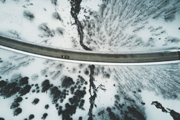
A stormy nation is expected to become even stormier, bringing rain and snow that is known to increase the number of vehicle accidents.
The exact degree of increased risk has been the subject of numerous studies, but most of them relied on police reports or field observations that may not have accurately assessed whether there was precipitation at the time of the accident.
But now, researchers at the North Carolina State University say they have calculated a more precise measurement of the relative risk that precipitation has on fatal highway accidents. They used high-resolution radar data that pinpoints the location of precipitation within a few hundred meters and determines whether it was light, moderate or heavy at a given point in time.
A paper soon to be published in the Bulletin of the American Meteorological Society concludes that the risk of a fatal vehicle accident increases by 34 percent during a precipitation event. That falls within the range of a previous study based on observations that put the increased risk from 10% to 76%.
The North Carolina State University analysis goes further than previous studies in that it also projects the increased risk during heavy precipitation events. The radar data shows that driving in heavy rain or snow increases the chance of dying in a crash by 246 percent. That compares to 127 percent for light precipitation.
The analysis also found that the greatest risk of precipitation causing a fatal motor vehicle accident occurs during the morning rush hour. Oddly, there is not a similar spike in relative risk during the evening rush hour.
Scott Stevens, the lead author of the study, what makes the radar data analysis unique is the precision, in both time and space, that the measurements are taken. Precipitation can vary widely across even small areas, he said. When an accident is reported, the responding officer has to guess if it was raining at the time based on the conditions he observed at his location. The location often is reported at the nearest crossroad.
The advent of the Global Positioning System allowed location data to be reported more precisely. High-resolution radar that came about in the late 1980s also showed the density and location of precipitation more accurately.
Stevens, who works for the Cooperative Institute for Climate and Satellites, said the research team used data from 130 weather radars scattered about the United States and plotted the level of precipitation into 25 million quadrants, each one one-hundredth of a degree of latitude and longitude across. That’s about 850 meters in most places, depending on how far north or south.
Into that grid, the researchers entered the location of 125,012 fatal car crashes spanning the entire continental United States over a six-year period, from 2006 to 2011.
The analysis shows that rural locations are more risky in bad weather than urban locations. Stevens said that likely is because motorists drive faster out on the open highway than they do in town.
The analysis also plots the degree of relative risk in nine zones: The Northern Rockies and Upper Midwest have the highest relative risk for vehicle fatalities caused by precipitation. Seasonally, the analysis found winter if the riskiest time of year for a precipitation-caused fatal crash.
And times are getting riskier. The study notes that the National Climate Assessment in 2018 determined that annual precipitation in the United States has increased since 1900, varying by climate region, and is expected to continue increasing in the future. Other research shows that heavier downpours are more common than in the past and the trend is to continue in greater frequency.
Stevens said he think the research will be useful to the insurance industry, although he wouldn’t venture to guess what practical applications it may bring.
“The most likely, we are thinking, is this is kind of similar to public information campaigns about testing and driving,” the said. “This may be an unappreciated risk.”
The impact of weather on highway safety will grow in importance as the nation moves toward self-driving cars, says the University Corporation for Atmospheric Research (UCAR) in a briefing delivered to Congress last week.
Researchers are focusing on networks of roadside sensors, improved computer models, and communication systems that connect vehicles to infrastructure to provide motorists with greater situational awareness of road conditions. Such networks will be important for autonomous vehicles that will have to make rapid adjustments in adverse weather conditions, according to the paper.
The nonprofit research group says advances in technology are also transforming cars into data collection devices. UCAR President Antonio Busalacchi said in an interview that precise weather data of the type used in the radar-data study could likely play some role in improving forecasting.
Busalacchi said the vast majority of the nation’s highways are rural, where autonomous cars have more trouble finding cues such as sign posts to gain awareness of their environment. He said the nation needs to start investing in information collection as part of infrastructure. He calls it “info-structure.”
“We hear a lot about loss of life from weather events: hurricanes and tornadoes,” Busalacchi said. “The No. 1 killer — of weather-related loss of life — is traffic accidents.”
Was this article valuable?
Here are more articles you may enjoy.
 New EVs From Toyota, Subaru Breathe Life into Struggling Market
  Insurer Interest in AI Exclusions Growing as Risk Becomes Omnipresent
  Citadel Securities Asks to Join Susquehanna Insider-Trading Suit
  Software Firm CCC Intelligent Solutions Exploring Sale: Reuters
Want to stay up to date?
Get the latest insurance news
sent straight to your inbox.