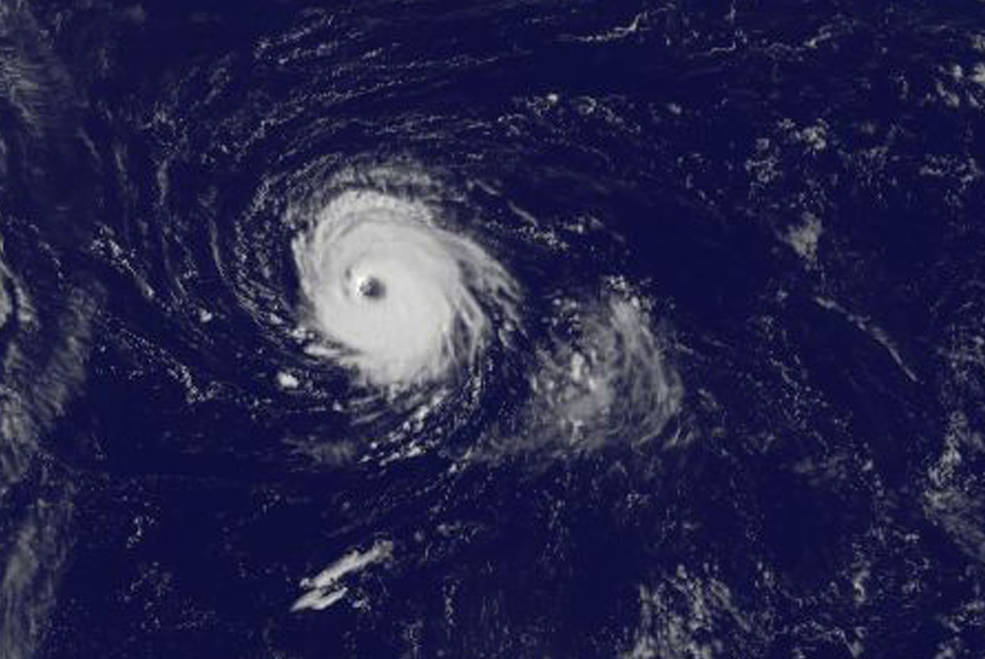
Harvey, Irma and Maria have written new chapters into Atlantic hurricane history this past month, but the story isn’t over. Storms certainly will keep coming as the action now shifts to the western Caribbean Sea – Sandy’s birthplace.

Storms Lee and Maria soon will spin themselves down in the central Atlantic, then there will be a pause as there’s no prediction new storms will develop in the next few days to replace them. After that, the forecast models show there could be trouble, said Dan Kottlowski, a hurricane forecaster at AccuWeather Inc. in State College, Pennsylvania.
“People ask me: ‘Once we get past September, we’re over the hump?’ Not true,” Kottlowski said. “Don’t let your guard down.”
At least 100 people have died in the U.S. and Caribbean this year since Harvey came ashore in Texas on Aug. 25 flooding portions of the state. It started a month of mayhem that included Irma striking Florida and Cuba, and Maria hitting Dominica, the U.S. Virgin Islands and Puerto Rico. Economic losses in the U.S. could reach $170 billion, according to Enki Research in Savannah, Georgia.
Across the entire basin, damage could total $300 billion, said Joel Myers, the founder, president and chairman of AccuWeather.
The storms had deep impacts on markets as well. Harvey temporarily shut down about 25 percent of oil and natural gas production in the Gulf of Mexico and as much as 20 percent of U.S. refining capacity. Hurricane Irma subjected Florida’s citrus groves to fruit losses that have wiped out some farmers. Maria knocked out Puerto Rico’s entire power grid.
“In past years, we would say, ‘Wow, imagine if that storm went here and there, imagine the damage it would cause,’ ” Kottlowski said. “That happened this year.”
13 Storms
So far 13 storms have formed across the Atlantic, one more than an average year. However, 2017 has already met the definition of “extremely active,” and the amount of energy the storms produced in September set a new record for the month, according to Phil Klotzbach, lead author of the closely watched Colorado State University seasonal-hurricane forecast.
This also was the first time the U.S. was hit by three Category 4 storms in one season, said Jeff Masters, co-founder of Weather Underground in Ann Arbor, Michigan, and the first time since 2005 that a major hurricane struck the U.S.
As autumn gets underway in the Northern Hemisphere, the Atlantic between the Caribbean and Cabo Verde cools, wind shear picks up there and tropical waves rolling off Africa, the buds of storms, start to wind down, said Dennis Feltgen, spokesman for the National Hurricane Center in Miami.
Shifting Westward
“The activity shifts westward,” Feltgen said. “The western Caribbean is still quite warm in October and can easily generate some memorable hurricanes. Both Wilma in 2005 and Sandy in 2012 began there.”
Storms that form south of Cuba are most likely to drift northeast, according to the hurricane center. This was Sandy’s path, crossing Cuba and heading up the U.S. East Coast. Wilma also developed in the western Caribbean. After tracing a boomerang-shaped path, it headed north into Florida, causing about $20 billion in damage and killing more than 20 people across the basin.
This year, conditions are particularly ripe for a burst of late season Caribbean storms, Klotzbach said. In October and November, a broad area of low pressure develops across the western Caribbean, and this atmospheric gyre can help get storms started, he said. This year there are also borderline La Nina conditions in the Pacific. While this cool water and atmospheric turmoil is an ocean away, it still can give conditions across the Caribbean a boost.
‘Threat Region’
Another ingredient in the storm recipe book is warm water, and the Caribbean is bathwater hot right now. “I cannot say for sure that we are going to see anything nasty come out of the Caribbean, but I would say the odds of something in the western Caribbean are fairly high this year,” Klotzbach said. That would shift the “threat region” to Florida, he noted.
AccuWeather predicts at least four more named storms, with three becoming hurricanes, Kottlowski said. One probably will be major: Category 3 or stronger on the five-step Saffir-Simpson scale. A storm gets a name when its winds reach 39 miles (63 kilometers) per hour, or tropical-storm strength. The odds are pretty high one of these four will hit the mainland.
“There is a pretty good chance for a landfall in the U.S. sometime between now and the end of the season,” Kottlowski said. “If I lived along the coast, I would keep my hurricane plan right next to the door.”
Was this article valuable?
Here are more articles you may enjoy.


 California Jet Fuel Woes Deepen as Asia Flows Hit Decade Low
  Report: Cargo Theft Down for Quarter, But Criminals Are Getting More Savvy
  Bayer Gets Mixed Reception at Supreme Court on Roundup Suits
  Travelers to Expand Homeowners Insurance Offering in California