Though drone usage is mainly used in disaster response currently, a new report highlights the benefits of using drones in all four stages of the disaster life cycle: prevention, preparation, response and recovery.
Zurich North America, a co-sponsor of the study, revealed the findings during a news conference in New Orleans recently at the Risk Insurance Management Society’s (RIMS) annual conference. The study was a coordinated effort among public and private sectors and included Guy Carpenter & Co., USAA and Willis Group.
The report outlines some of the most promising uses for drones in disaster relief, including:
- Reconnaissance and Mapping;
- Structural Assessment;
- Temporary Infrastructure / Supply Delivery;
- Wildfire Detection and Extinguishing;
- High-Rise Building Fire Response;
- Chemical, Biological, Radiological, Nuclear or Explosive (CBRNE) Event;
- Search and Rescue Operations;
- Insurance Claims Response and Risk Assessment.
In advance of a disaster, drones can be used in risk assessment, mapping and planning.
“When individuals, businesses, and communities are able to understand and manage risks and plan effectively, they reduce overall damage and losses. Rebuilding and recovery are then able to begin more quickly, ultimately strengthening the resiliency of communities,” the report says.
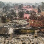
After a disaster, drones can: help relief workers understand the big picture, locate survivors more quickly, perform structural analysis of damaged infrastructure, deliver supplies and equipment and evacuate casualties and help out put fires.
Besides helping disaster victims, drones can help keep recovery workers safe by providing aerial data in impacted areas deemed too dangerous to enter. The report cites nuclear radiation contamination and wildfires as examples.
Drones can even relay Wi-Fi, radio communications and cellular phone service.
Some of the benefits of utilizing drone technology in disasters include:
- Less exposure by disaster workers, claims adjusters and risk engineers to unnecessary danger.
- Enhanced effectiveness of responders.
- Unique viewing angles not possible from manned aircraft.
- Highly deployable.
- Cost-efficiency.
The study, conducted by Measure, a 32 Advisors Company, in coordination with the American Red Cross, recommended the Federal Aviation Administration (FAA) expedite emergency flight authorization for drone use by insurers as soon as a disaster occurs. That’s because research has shown that reducing the timeline in the early phases of recovery can expedite the process and may even result in more survivors being found. The average lag time for drones used after a disaster is currently six and a half days.
“An emergency COA [certificate of authorization] process for private sector and non-profit organizations would grant authorization within 24 hours, allowing for rapid response in the wake of a disaster declared by a governor or other relevant state or territory authority, or FEMA,” the report recommends.
Currently, FAA policy doesn’t allow private sector companies to use drones for disaster recovery purposes. FAA policy also currently restricts drones from flying over populated areas and limits operation to remote locations, conditions that the report finds “will greatly reduce the benefit of operating drones for disaster relief efforts.”
The report, Drones for Disaster Response and Relief Operations, outlines the value insurers could provide in the initial aftermath of a disaster for risk assessment, mitigation and claims response. “Such an effort would better support people, businesses and communities to more quickly begin their recovery process post- disaster,” the authors write.
“With Zurich’s experience and role in redevelopment after events such as Hurricane Katrina and Superstorm Sandy, we know the importance of recovery and building resilient communities,” said Dan Riordan, CEO of Global Corporate in North America for Zurich. “For Zurich and other insurance companies, we see drones playing a key role during those first critical hours and days following disasters.”
The result of such authorization could mean more accurate response efforts and quicker claims turnaround.
“The real time acquisition of aerial imagery after a disaster will allow for the rapid deployment of personnel to assess damage and save lives,” said Brandon DeClet, CEO and co-founder of Measure. “This improved response time will lower the long-term costs of recovery and help to rebuild communities faster.”
Drones in Insurance
Drones could benefit insurers in a variety of ways. Drones could help insurers’ initial response to an emergency.
“It is in both property owners’ and insurance companies’ interests to mitigate any damage that occurs in the wake of a disaster. By flying drones fitted with mapping sensors…over a flooded area, for example, insurance companies can identify what properties and infrastructure have been flooded or are in the path of rising waters,” the report says.
The study notes that insurance risk managers could utilize aerial data captured by drones to “better understand the factors leading to property damage and make recommendations for mitigating losses.”
Additionally, insurers can aid pre-disaster planning with drones. To support claims assessments and help policyholders understand and mitigate disaster risks, insurers could use drone-acquired high-resolution maps of communities with insured properties before a disaster. The maps could highlight at-risk areas, like low-lying communities near rivers.
As logistics support, “insurers could use drones and the data they collect to support the claims process and enhance pre-disaster risk assessments for businesses and individuals.”
According to the study, broad adoption of drone technology would be hampered unless “public and private organizations could find a way to avoid the capital expense associated with owning and operating their own drone fleets.”
The report suggested that larger insurers might consider maintaining a drone fleet “near disaster-prone areas or high-density populations”.
Or rather than owning and maintaining a drone fleet, public and private entities could benefit from a pay for use service. One such product, offered by Measure, allows the acquisition, processing and delivery of data from drones when needed. This, the reported states, “eliminates the need for organizations to maintain a large fleet of drones that may be used only rarely. Drones also quickly become obsolete as the technology advances.”
Zurich’s claims and risk engineering teams are reportedly working to evaluate the best ways to leverage aerial data acquired through drones – whether through contracted services, company-owned drones or leased drone fleets. Zurich has already conducted research and testing of micro-drone platforms in Spain and Canada.
Other Recommendations
In addition to expedited flight authorization, the report offers these recommendations:
- Encouraging data sharing among government, private sector and commercial drone operators to maximize response strategy, speed and efficiency.
- Encouraging the development and implementation of Privacy Best Practices for drone operations.
- Developing a defined process for scaling up FAA staff resources to quickly process flight requests when necessary.
- Adapting FAA drone regulations constantly as airspace integration and deployment models evolve.
Of the additional recommendations, data sharing is rated as the most important since it promises to eliminate the need for drone flights from multiple responding organizations.
Drone Types
Drone types, typically categorized by size and altitude of operation:
Group 1 – Under 20 pounds operating at altitudes under 1000 feet. Typically battery powered, can carry small payloads, short endurance time of between 20 minutes and 2 hours.
Group 2 – Weighs between 21 and 50 pounds and can operate up to 3500 feet. Gas or diesel operation with up to 24 hours endurance. Limited payload capacity, can carry high quality camera/communication systems.
Group 3 – Weighs up to 1320 pounds and can reach altitudes of 18,000 feet. Six to 10 hour endurance time. Greater payload carrying capability.
Group 4 – Weighs in at over 1320 pounds and may be optionally piloted. Autonomy kit on board. May be used in heavy lift operations.
Group 5 – Exceeds 1320 pounds, typically the same size as manned aircraft but without a pilot. Used quite mainly by the military.
Drones can carry cameras, communications, mapping sensors, sniffers, cargo holds, firefighting tools and can act as a cell phone/Wi-Fi tower as well as broadcast AM/FM radio signals.
Was this article valuable?
Here are more articles you may enjoy.
 Berkshire Utility Presses Wildfire Appeal With Billions at Stake
  Uber Jury Awards $8.5 Million Damages in Sexual Assault Case
  LA County Told to Pause $4B in Abuse Payouts as DA Probes Fraud Claims
  One out of 10 Cars Sold in Europe Is Now Made by a Chinese Brand
Want to stay up to date?
Get the latest insurance news
sent straight to your inbox.