NASA plans to fly small drones to spot fires in a wildlife refuge along the Virginia and North Carolina border next spring, marking the first time the agency has integrated drones into the National Airspace System for wildfire spotting on the East Coast, officials said Wednesday.
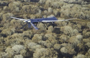
NASA has previously used retrofitted Predator drones to map and gather data on large wildfires in the West. Those drones were piloted by ground crews and flew at high altitudes for hours at a time.
Researchers at NASA’s Langley Research Center in Hampton plan to use former Army target drones that are semi-autonomous to fly over the Great Dismal Swamp at low altitudes for about an hour at a time. The drones will be flown at altitudes lower than 700 feet after lightning storms next year, and can be launched by hand or from a small patch of land at the refuge. The drones will be used as part of a one-year agreement between NASA and the U.S. Fish and Wildlife Service to help detect brush and forest fires.
The idea for using the drones came from NASA researcher Mike Logan, who lives north of the swamp and grew frustrated by smoke from wildfires inundating the region.
In 2011, a forest fire in the swamp lasted nearly four months and cost more than $10 million to put out. The fire was caused by a lightning strike and smoke from it traveled as far north as Maryland.
The only way for officials to spot fires in the nearly 50,000-square acre refuge is to hire an aircraft and do an aerial survey. Logan said using the drones would cost about $25 per hour, compared with upward of $2,000 an hour to rent a manned helicopter or airplane.
“The agency hopes to see a significant decrease in cost to survey the Great Dismal Swamp, as well as a reduction in time to detect nascent fires, which could potentially save millions of dollars to the taxpayer in firefighting costs,” Great Dismal Swamp Refuge Manager Chris Lowie said in a statement.
Logan said the drones will be equipped with cameras and sensors capable of detecting hot spots and transmitting live video to people on the ground, who can watch on a laptop.
The drone weighs about 15 pounds, has a nearly six-foot wingspan and a range of about eight miles before its battery needs recharging.
Logan said NASA officials are testing out the drones in a rural part of Virginia Beach, integrating them into the National Airspace System. He said safeguards are in place to ensure there are no collisions with manned aircraft.
“You always hear about the Predators and things like that, drones being used to blow people up,” Logan said. “Sometimes folks forget these platforms have a lot of uses that are really for the public’s benefit.”
Was this article valuable?
Here are more articles you may enjoy.
 UBS Top Executives to Appear at Senate Hearing on Credit Suisse Nazi Accounts
  Credit Suisse Nazi Probe Reveals Fresh SS Ties, Senator Says
  Charges Dropped Against ‘Poster Boy’ Contractor Accused of Insurance Fraud
  One out of 10 Cars Sold in Europe Is Now Made by a Chinese Brand
Want to stay up to date?
Get the latest insurance news
sent straight to your inbox.