View this article online: https://www.claimsjournal.com/news/west/2015/08/18/265177.htm
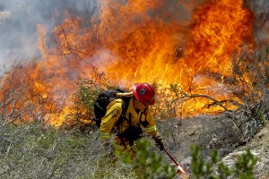
California is on fire—again. About 130,000 acres have been scorched in more than 20 major fires actively burning in the state, according to the California Department of Forestry and Fire Protection. But the flames are not the only danger.
Post-fire flooding and landslides can threaten lives, property and natural resources, which can include important municipal water reservoirs or habitat for endangered species. In work funded by the National Aeronautics and Space Administration (NASA), Mary Ellen Miller, a research engineer at Michigan Tech Research Institute (MTRI), uses models and NASA earth observations to help predict erosion and runoff in areas burned by wildfire. Right now, Miller is validating model results for the High Park Fire that burned in Colorado in 2012. Last year her team modeled hill slope erosion for four Californian fires.
“Preparation is a key component of disaster management,” Miller says, explaining that adequate preparation and response to wildfire takes planning and team work.
After a fire, Burned Area Emergency Response (BAER) teams are formed to assess potential erosion and flood risks. If necessary, BAER teams develop remediation plans to protect lives and natural resources. The teams operate under very tight deadlines – typically sites must be assessed and treatments recommended within two weeks of containment of a fire. Miller and her research team are working hard to prepare tools and datasets that allow BAER teams to rapidly assess and predict post-fire effects using hydrological models and satellite imagery of fire impacted forests, shrublands and grasslands.
Not all fire damage is preventable. But after a wildfire strips away the ground cover and litter layers, BAER teams can intervene. They can remediate burned areas—by laying down mulch or planting quick-growing seeds—protecting the area from further damage caused by runoff and erosion.
“In order to be effective, those treatments must be in place before the first major storm hits,” Miller says, adding that her team focuses on assessing an area’s risk by looking at hydrologic models and satellite imagery.
Source: Michigan Technological University