View this article online: https://www.claimsjournal.com/news/west/2013/08/12/234677.htm
When summer monsoons bring thunderstorms to Southwest Colorado, lightning bolts can come fast and furious.
Justin Moore, assistant manager of the Durango Interagency Fire Dispatch Center made the point by displaying a map showing one week of lightning strikes in the area bounded by Red Mountain Pass to the New Mexico state line and from Utah’s eastern border to Wolf Creek Pass.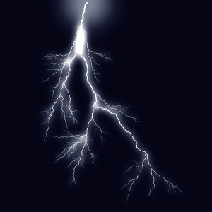
Blue dots denoting the location of individual hits are so concentrated the map appears largely a mass of blue. The map for the period July 19-25 shows 41,318 bolts of lightning reached the ground, Moore said.
Moore and fire dispatch colleagues in Durango track the hits through the United States Precision Lightning Network (USPLN) to know where lightning is most active and could spark wildfires. The hits appear on the USPLN map within 30 seconds of occurrence.
The USPLN is a grid of sensors that register cloud-to-ground lightning strikes over the Lower 48 and report the time and location to central processors in Massachusetts and Florida via the Internet. Each finger of a bolt is recorded, not just the flash alone.
Simulations show that the system detects 95 percent or more of strikes and locates them, on average, within 250 meters (820 feet).
When smoke or fire is reported by someone on the ground or is spotted by aerial surveillance, the fire dispatch center consults the USPLN map to get a precise location before dispatching a crew to investigate.
Moore said it’s not uncommon to register 6,000 lightning strikes in 24 hours. The center can see up to 40 fires a day, many of them a single tree, he said.
“It’s a smoke report until an incident commander says it’s a fire,” Moore said.
If there is a fire, the dispatch center coordinates suppression for the U.S. Forest Service, Bureau of Land Management, the National Park Service, the Bureau of Indian Affairs and five counties – La Plata, Hinsdale, Archuleta, Montezuma, San Juan and Dolores.
After the first 100 USPLN sensors were installed over the continental United States in 2004, the network has expanded to about 150 sensors, covering over Alaska, Canada, the Caribbean and Central America. Sensors also have been placed in South America.
Aircraft activity is tracked on a transponder on a wall of the dispatch center. Five employees are on duty normally, but the center and adjoining offices in the Public Lands Center can have as many as 25 people working during big fires.
“We contact aircraft every 15 minutes,” Moore said. “We want to hear their voice. If we don’t have contact with them for 30 minutes, we start a search and rescue.”
The USPLN information is proprietary. TOA Systems Inc. and Weather Decision Technologies created the system in 2004. In 2007, WSI Corp. bought Weather Decision interests.
Data produced is bought by the federal government and made available to specified users such as fire management agencies to locate and fight wildland fires.