DigitalGlobe announced that RMTC/URS, along with Kauai County and the State of Hawaii, has purchased high-resolution DigitalGlobe’s QuickBird satellite imagery for more effective digital mapping in Hawaii.
RMTC/URS is a joint venture of R.M. Towill, URS, Dewberry, TerraPoint, Airborne1, and Sea Engineering, and provides flood hazard engineering and mapping services to the U.S. Department of Homeland Security’s Federal Emergency Management Agency (FEMA).
DigitalGlobe’s imagery of Kauai County and the infamously rainy Waimea Canyon will reportedly allow local, state and federal entities to more effectively pursue flood plain mapping projects and disaster mitigation initiatives.
According to Stephanie Routh at joint venture partner Dewberry, “Two-foot pixel resolution satellite imagery that meets FEMA base map specifications for accuracy and distributability for Digital Floodplain Insurance Rate Mapping (DFIRM) is a great tool.
DigitalGlobe’s satellite imagery gives local, state and federal agencies access to much-needed data over regions of Hawaii that historically have been challenged by terrain and topography, and allows us to make a better DFIRM product for the communities.”
DigitalGlobe delivered to RMTC/URS a Digital Ortho Quarter Quad product. Comprised of QuickBird satellite imagery, the DG DOQQ provides quality imagery at the highest resolution, reportedly making it an up-to-date tool for regional mapping projects, especially in more remote areas such as the Pacific Islands.
The DG DOQQ offers a two-foot resolution, georeferenced, seamless digital image mosaic. The solution is reportedly ideal for government and commercial customer applications, including geographic information system (GIS) updates, map creation and revision, emergency management, and natural resource management.
Many mapping experts traditionally rely on U.S. Geological Survey (USGS) DOQQs for their imagery needs. The DG DOQQ reportedly differs from the USGS DOQQ in that it has a higher resolution, more image options and multiple projection options.
In this case, RMTC/URS, Kauai County, and the State of Hawaii shared the cost to purchase the four-band multispectral, pan-sharpened imagery.
This DOQQ includes coverage of the entire island of Kauai, as well as a buffer around the island that illustrates bathymetric data, coral reef mapping and other features. The product allows Kauai County to now begin a full GIS program that will benefit local, state and federal agencies alike.
Was this article valuable?
Here are more articles you may enjoy.
 Report: Vehicle Complexity, Labor ‘Reshaping’ Auto Insurance and Collision Repair
  Viewpoint: The Impact of Behavioral Health on Workers’ Comp
 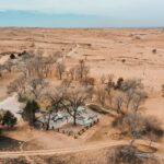 Texas Among Several States Facing New Fire Risks: Weather Watch
  Dog-Related Injury Claim Payouts Hit $1.12B in 2023, Report Shows
Want to stay up to date?
Get the latest insurance news
sent straight to your inbox.