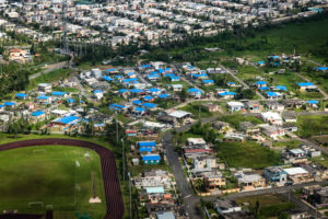
 Dorado, Puerto Rico, Feb. 13, 2018–Blue roofs are visible in the town of Villa Santa in the municipality of Dorado. FEMA/K.C. Wilsey
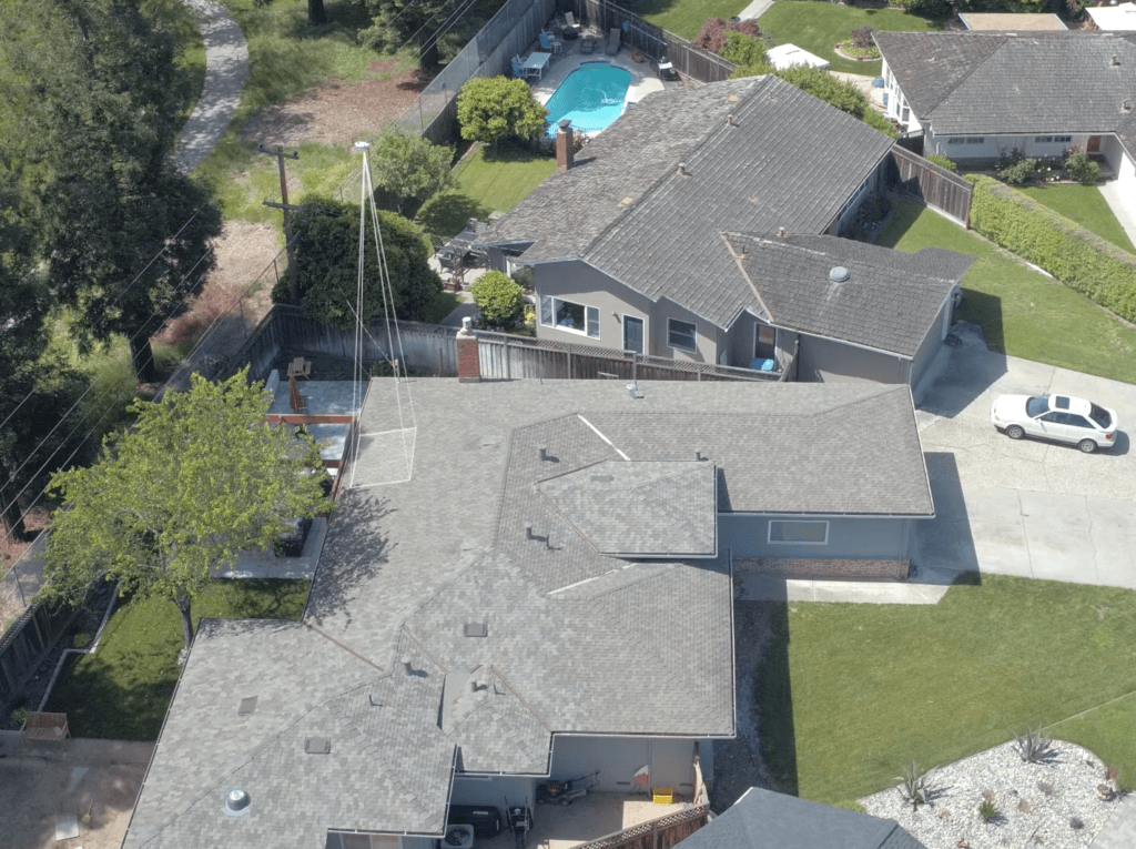
While aerial imagery offers the broadest range of images with the highest refresh rates, it isn’t usually at a high resolution, said Doug Jentzsch, director at Geomni, a Verisk business.
In two recent interviews with Claims Journal, Jentzsch discussed aerial and ground imaging.
Aerial imagery is typically obtained via satellites and planes and can cover a broad area, offering details of a property or structure. It can be helpful in assessing risk, like measuring vegetation distance from a home or business. Images captured this way offer high value from a change detection standpoint, he said.
“In the past, there wasn’t a really good way to be able evaluate broad area risk or individual property risk without just getting somebody onsite every time,” said Jentsch.
Insurers can also see the current state of a given property after a catastrophe allowing them to more accurately deploy resources, Jentzsch added.
In recent years, drones have been added to claim department toolboxes. Drones offer the ability to conduct individual property inspections and provide the highest resolution images.
“Drones are great for individual inspections,” said Jentzsch.
The aerial images acquired from satellites, planes and drones contain meta data about a property including dimensions, area, slope and elevations.
Sometimes a property’s details can be obscured from aerial view. Smartphone and tablet cameras offer a good option for obtaining ground imagery. Images captured by smartphones offer similar meta data as provided by aerial imagery.
“One of the biggest advantages is just being able to see parts of the structure that otherwise were obscured,” Jentzsch said of ground imagery.
An insurer will benefit from a combination of methods for obtaining property imagery.
“Adding ground imagery and combining it with what you gather from aerial imagery, that’s really the best combination of being able to get the most complete view of a structure,” said Jentzsch.
Was this article valuable?
Here are more articles you may enjoy.
 Justice Department Preparing Ticketmaster Antitrust Lawsuit
  California Chiropractor Sentenced to 54 Years for $150M Workers’ Comp Scheme
  Hawaiian Electric Hits 40-Year Low Ahead of Maui Fire Report
  Report: Vehicle Complexity, Labor ‘Reshaping’ Auto Insurance and Collision Repair
Want to stay up to date?
Get the latest insurance news
sent straight to your inbox.