The U.S. national weather forecaster has called off its El Niño watch five months after raising the alert as it is now less likely that the much-feared phenomenon that can wreak havoc on global weather will emerge.
Since June, the weather forecaster had predicted that El Niño conditions, essentially a warming of waters in the equatorial Pacific Ocean that can cause a major drought in Asia, would develop gradually during the Northern Hemisphere winter.
For the United States, El Niño can bring higher than average winter precipitation to the Southwest, less wintry weather across the North as well as stronger winter storms in California and increased storminess across the southern states.
“The previous El Niño watch has been discontinued as the chance of El Niño has decreased,” the Climate Prediction Center (CPC) said on Thursday in its monthly report.
While the chances of El Niño are low, the CPC said the tropical ocean and atmosphere may still resemble a weak El Niño at times, with sea surface temperatures above average.
“While the development of El Niño, or even La Niña, cannot be ruled out during the next few months, … neutral is now favored through the Northern Hemisphere winter 2012-13,” it said.
La Niña is El Niño’s less infamous counterpart and cools the waters in the equatorial Pacific, mainly causing crop-killing droughts in the Americas.
The phenomenon was blamed for last year’s crippling drought – the worst drought in a century – in Texas, the biggest cotton growing state in the United States and only disappeared at the end of April.
El Niño leads to a heating of Pacific waters, triggering drought in Southeast Asia and Australia, which produce some of the world’s major food staples, such as sugar cane and grains. It can also cause flooding in South America.
The CPC is part of the National Oceanic Atmospheric Administration (NOAA).
Was this article valuable?
Here are more articles you may enjoy.
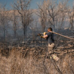 Wildfires Are Upending Some of the Safest Bets on Wall Street
  Supplemental Claims Don’t Need to Include Damage Estimates, Fed Appeals Court Says
 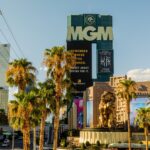 MGM Resorts Sues US FTC to Stop Investigation of Casino Hack
  Sanofi to Pay $100 Million to Settle Zantac Cancer Lawsuits
Want to stay up to date?
Get the latest insurance news
sent straight to your inbox.