Hurricane Humberto, the season’s first, churned in the Atlantic west of the Cape Verde Islands as Tropical Storm Gabrielle stalled after passing Bermuda.
Humberto was declared a Category 1 storm in a 5 a.m. advisory from the U.S. National Hurricane Center, missing the record for tardiest first hurricane by three hours. Since 1967, when satellites have had the ability to watch the Atlantic continuously, the latest such a powerful storm formed was 8 a.m. on Sept. 11, 2002, according to Dennis Feltgen, a spokesman for the center.
Storm warnings for Bermuda were dropped as Gabrielle sat stationary 55 miles (89 kilometers) to the west with maximum sustained winds of 50 miles per hour, the center said in an advisory at 8 a.m. New York time. The center of the storm passed west of the islands.
“A slow northwestward motion is expected to resume later today and continue through the night,” Michael Brennan, a senior hurricane specialist at the Miami center, said in the advisory. “A gradual turn toward the north is expected Thursday and Thursday night.”
The turn will put the storm on track to sweep by Nova Scotia and strike Newfoundland later this week, according to Environment Canada.
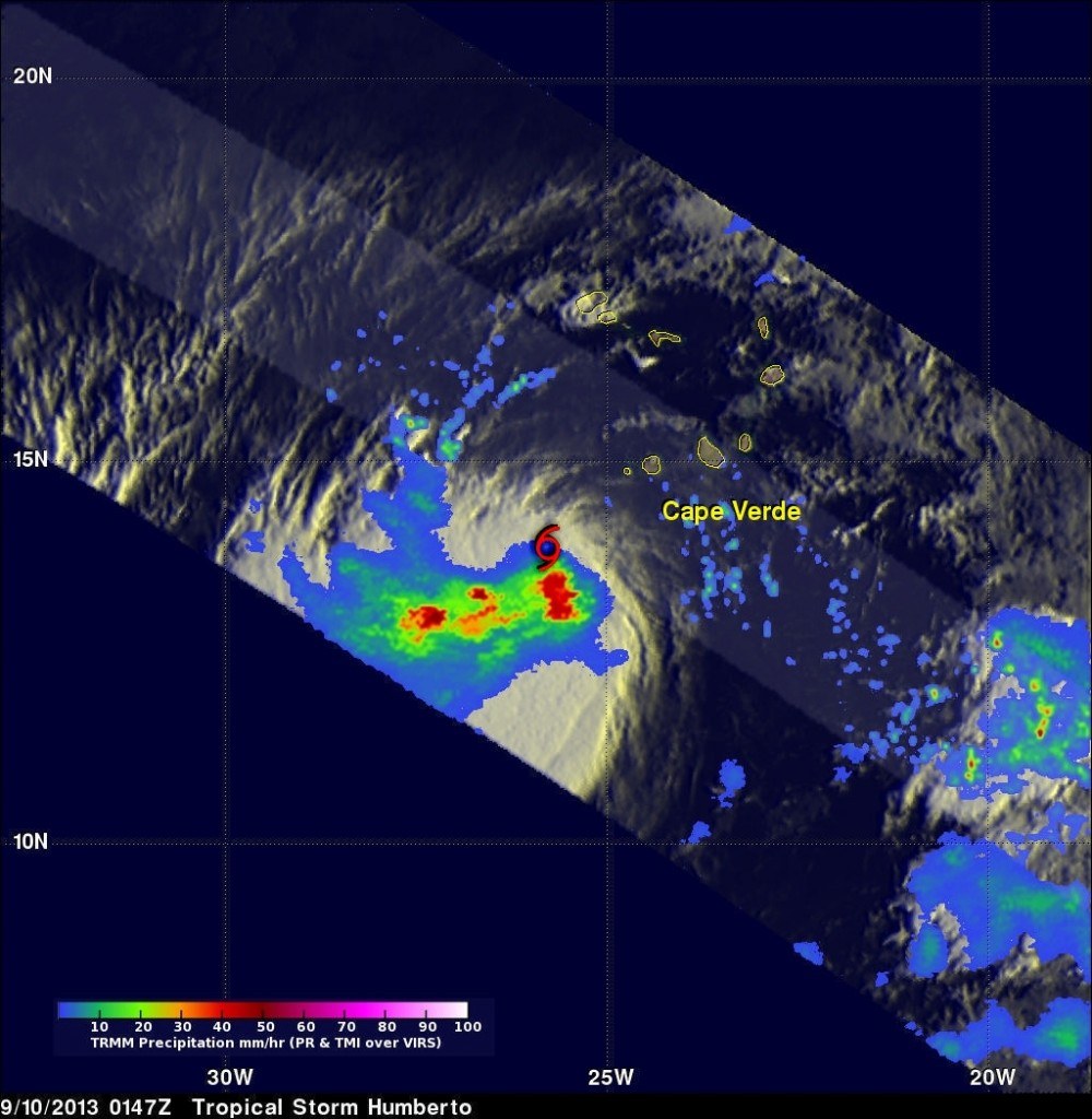
Image Credit:
SSAI/NASA, Hal Pierce
Humberto has maximum sustained winds of 75 mph and was about 310 miles west-northwest of the Cape Verde Islands at 5 a.m. The system currently isn’t a threat to land.
Weakening Tomorrow
“Humberto could strengthen more today before a weakening trend likely starts on Thursday,” Eric Blake, a hurricane specialist at the center, wrote in an advisory.
Eight named storms have formed in the Atlantic so far this season, which began June 1 and runs through Nov. 30. The systems are followed closely by energy and commodity markets because they can disrupt supply and demand of petroleum products, natural gas and crops.
The Gulf of Mexico is home to about 6 percent of U.S. natural gas output, 23 percent of oil production and more than 45 percent of petroleum refining capacity, according to the U.S. Energy Department. Florida, which is struck by tropical systems more often than any U.S. state, is the second-largest producer of oranges after Brazil.
A system gets a name when its winds reach 39 mph and it becomes a tropical storm. Yesterday was the statistical peak of the Atlantic season.
The hurricane center is also tracking two areas of disturbed weather that may strengthen into tropical systems.
The first, near Mexico’s Yucatan Peninsula, is expected to move into the Bay of Campeche tomorrow and has a 70 percent chance of becoming a tropical depression or storm in the next five days, the center said. Petroleos Mexicanos, Mexico’s state- owned oil company, known as Pemex, has rigs in the bay.
The system is also forecast to bring heavy rains across the Yucatan, Belize and Guatemala in the next two days.
The second area is about 700 miles east of the Leeward Islands and has a 10 percent chance of becoming tropical in the next five days.
(Editors: Charlotte Porter, Margot Habiby)
Was this article valuable?
Here are more articles you may enjoy.
 EVs Head for Junkyard as Mechanic Shortage Inflates Repair Costs
  Viewpoint: The Impact of Behavioral Health on Workers’ Comp
  MGM Resorts Sues US FTC to Stop Investigation of Casino Hack
  Poll: Consumers OK with AI in P/C Insurance, but Not So Much for Claims and Underwriting
Want to stay up to date?
Get the latest insurance news
sent straight to your inbox.