Tropical Storm Gabrielle isn’t expected to gain much strength as it churns in the Caribbean Sea on a path between Puerto Rico and the Dominican Republic, the U.S. National Hurricane Center said.
Gabrielle was about 65 miles (105 kilometers) west- southwest of Ponce, Puerto Rico, at 8 a.m. New York time, with top winds of 40 miles per hour, the Miami-based center said in an advisory. The storm is bringing heavy rains to Puerto Rico and adjacent islands.

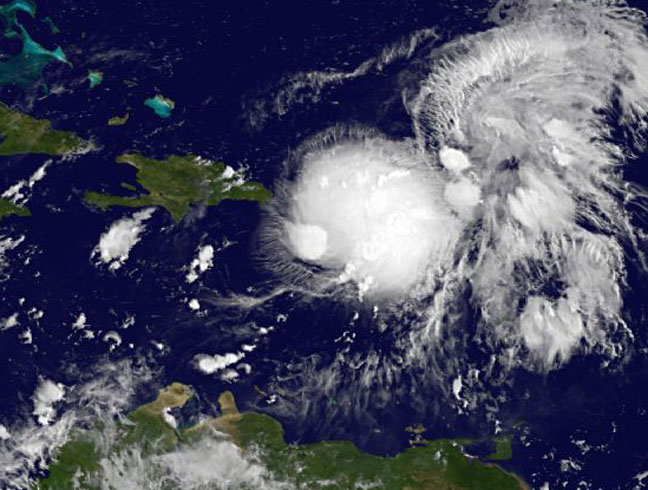
Image Credit:
NASA GOES Project
“Gabrielle is currently poorly organized and little change in strength is expected today,” the center said. “Some slight strengthening is possible tonight and Friday,” although the system isn’t expected to reach hurricane strength in the next five days.
The current track forecast takes the system through the Mona Passage, a part of the Caribbean that separates the Dominican Republic from Puerto Rico. Gabrielle is then expected to curve north and east into the Atlantic without becoming a further threat to land.
A flash flood watch has been posted for Puerto Rico and the U.S. Virgin Islands through tomorrow, according to the National Weather Service in Carolina, Puerto Rico.
Three to 6 inches (8 to 15 centimeters) of rain may fall across the islands with as much as 12 inches in the mountains, the weather service said.
“These rains could cause dangerous flash floods and mud slides over mountainous terrain,” the agency said.
Seventh Storm
Gabrielle is the seventh tropical storm of the 2013 Atlantic hurricane season, which runs from June 1 to Nov. 30. None of the Atlantic systems has strengthened into a hurricane, which has winds of at least 74 mph.
The hurricane center is tracking three other areas of disturbed weather across the Atlantic that have the potential for becoming tropical systems. The most threatening of them is located in the Bay of Campeche, in the southwestern Gulf of Mexico.
Petroleos Mexicanos, Mexico’s state-owned oil company, has most of its output in the bay. The system has a 30 percent chance of becoming tropical in the next two days as it drifts west toward the coast of Mexico.
In the eastern Pacific, the hurricane center is tracking a tropical depression that is expected to grow into Tropical Storm Lorena later today and then follow a path parallel to Mexico’s Baja California peninsula.
The depression had top sustained winds of 35 mph and was 155 miles southwest of Manzanillo, Mexico.
(With assistance from Ramsey Al-Rikabi in Singapore and Lynn Doan in San Francisco. Editors: Charlotte Porter, Margot Habiby)
Was this article valuable?
Here are more articles you may enjoy.
 Bridge Disaster in Baltimore Gets FBI Criminal Investigation
  Dog-Related Injury Claim Payouts Hit $1.12B in 2023, Report Shows
  Viewpoint: How Generative AI Enables a Brighter Claims Future in 2024 and Beyond
  Texas Among Several States Facing New Fire Risks: Weather Watch
Want to stay up to date?
Get the latest insurance news
sent straight to your inbox.